Leaving Gjirokastra, we head toward the coast. We stop at
the “blue eye,” a source of a small river around which a pleasant park has
developed. It is not Blue Hole in Belize, but with the center 40 meters deep,
the colors range from turquoise to deep blue and the gushing water is cold,
clear and refreshing. Saranda is a short distance from here, and we first drive
up the hill overlooking the city to have lunch in celebration of our driver’s
birthday. It is the Ionian Sea that greets us and Corfu, a Greek island, comes
into view. In fact, Saranda is a gateway to Albania for those who take the
ferry from Corfu, and this is partially responsible for an apparent rapid
build-up of the city in recent years. Nonetheless, Saranda’s oceanside
promenade is pleasant and is filled with locals and tourists enjoying an
evening stroll.
.JPG) |
| Blue Eye: I wasn't going to go near the water after the mishap in Benja Canyon which ruined my camera. |
.JPG) |
| Saranda on Ionian Sea |
 |
| Saranda: stopping at a castle on a hill for lunch |
 |
| Saranda: we have taken a liking to grilled vegetables here and order them at every opportunity. |
 |
| Saranda: Ionian Sea with Corfu, Greece in view |
 |
| Saranda: a view from our hotel room. Corfu seen again. |
 |
| Saranda: promenade in the evening |
A half hour’s drive further south is the remarkable
archeological site of Butrint. Occupying a small peninsula along the
complex-shaped Ionian coastline, it has seen numerous civilizations come and go
with the dominant architecture from Hellenistic, Roman, Medieval and Venetian
eras. Entering the park, we are soon on a woodsy trail through the ruins, which
is somewhat reminiscent of Mayan sites that are covered with jungles. We hurry
to the museum before it closes which is located on the end of the trail. In the
museum courtyard, there is a physical archeology class going on. What a great
location for outdoor studying. Uttica College in New York has been running a
few-week college course at this location every summer and the professor offers
to take us to an excavation site the following day. But alas, we are traveling
nomads and have to move on.
 |
| Butrint: walking along the ruins |
 |
| Butrint: The Greek inscription seen on stones here announcing freeing of slaves in honor of Asclepius, 4th century BC. The theater is seen behind (right). |
 |
| Butrint: The 6th Century Baptistry has mosaic work covering the floor, which has been covered with soil for protection. Imagine the eight concentric circles of mosaics along with columns. Conservation is of course critical but this practice makes you wonder "if a tree falls in a forest..." |
 |
| Butrint: these walls along the inlets of Ionian Sea are a testament to history. |
.JPG) |
| Butrint: A luxury car ferry... one of Ali Pasha's castles in view. |
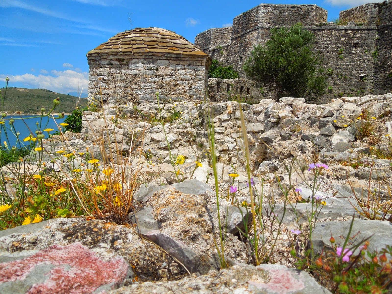
We are now heading up north along the section of the Ionian
coast, called Albanian Riviera. At Porto Palermo, we stop at one of the castles
built by Ali Pasha, an important ruler in the entire southern Albanian region
under the Ottomans during the late 18th and early 19th
century. Next stop is the Llogara National Park, where we drive up and up the
winding road to reach the top. After lunch we go downhill to our next
destination, Vlora.


.JPG)


No comments:
Post a Comment